
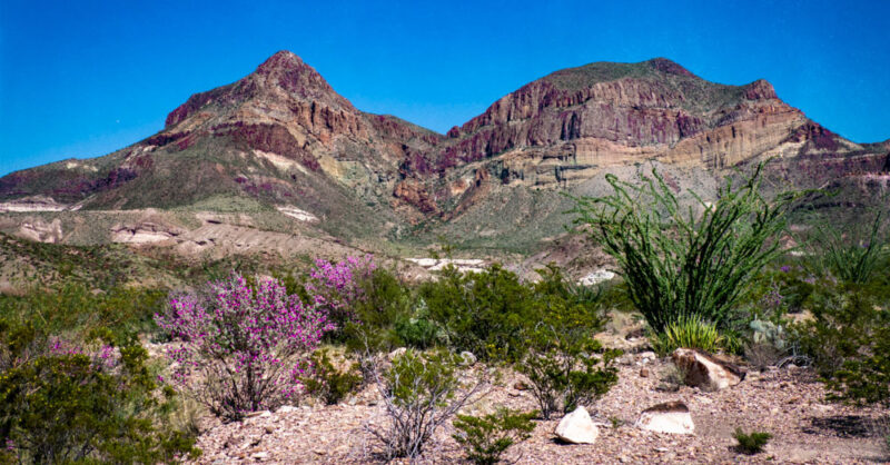
We arrived in the Big Bend National Park area on September 25 and found the area beautifully green with lots of blooming plants. One can only assume from good recent rains. The photo above shows Texas Sage and very green Ocotillo in front of beautiful mountains. The down side was parts of the park were closed, which meant we could not go to a couple of our favorite places.
We like to stay either in the park or, if we can’t do that, in the Terlingua/Study Butte area because it’s quick to get into the park from the west. In this case the park was not entirely open and staying there was not possible, so we stayed in an RV park in Study Butte, then on our way out, another night at a park in Marathon, north of the Big Bend, before heading toward home.
This is part 5, and the last part, of my First Pandemic Trip series of posts. We left Wimberley, TX, in our small motorhome in September 2020 heading for Colorado. Our first real destination was Palo Duro Canyon State Park, then the scenic route to Great Sand Dunes National Park, then Mesa Verde National Park, a quick drive through New Mexico where Texans were not welcome due to covid, then Monahans Sandhills State Park, and finally Big Bend National Park. I wanted to finish this blog post this week because this week is National Park Week!
A comment about the photographs. The air was hazy our entire trip, apparently from fires in California. That made it difficult to get clear pictures of things far away, and they sometimes get a bit of an unusual look…
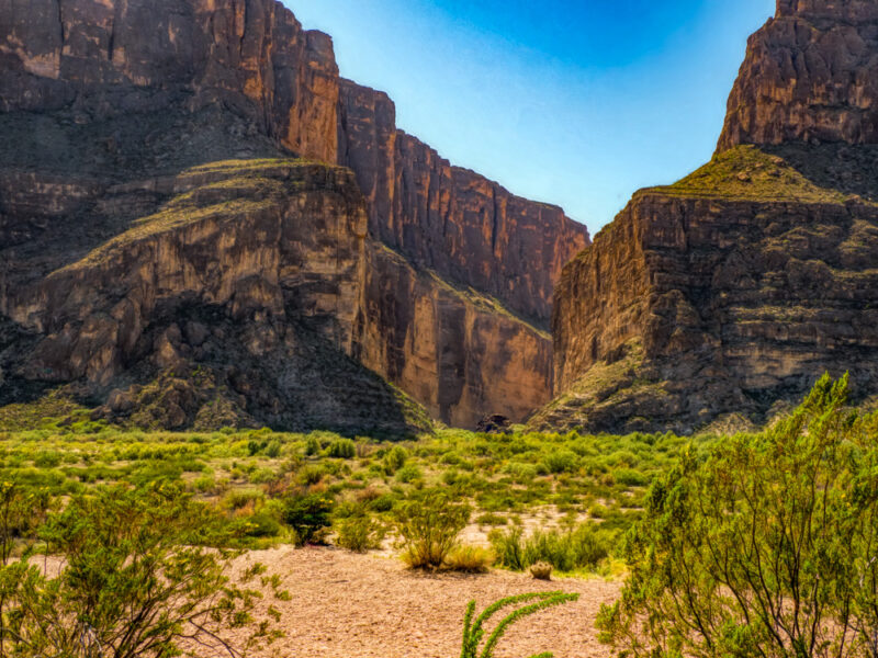
The first day we took Ross Maxwell Scenic Drive to the Rio Grande and Santa Elena Canyon. Old Maverick Road has been closed the last two times I’ve been to Big Bend National Park. If it is open and you are willing to brave a dirt road in your vehicle, it makes a nice loop with Old Maverick Road, which is paved. Another reason you may not be able to do this loop is if it has rained you may not be willing to brave the low water crossings near the Rio Grande.
As I wrote in the introduction, Big Bend was very green… The bushes with purple or blue flowers seem to be mostly Texas Sage, and they made a big impact.
At Santa Elena Canyon there are several vantage points from which you can simply view the river and the canyon, or cross Terlingua Creek and hike into the canyon. Rafting the canyon from a put-in at Lajitas is very popular.
The Rio Grande River forms the boundary between the United States and Mexico. You may find little items that have been (illegally) brought across the river for sale on rocks near the river. You are asked to leave a little money for them. I have a beloved little scorpion made of wire that I purchased that way. But I think you are officially told not to encourage them…
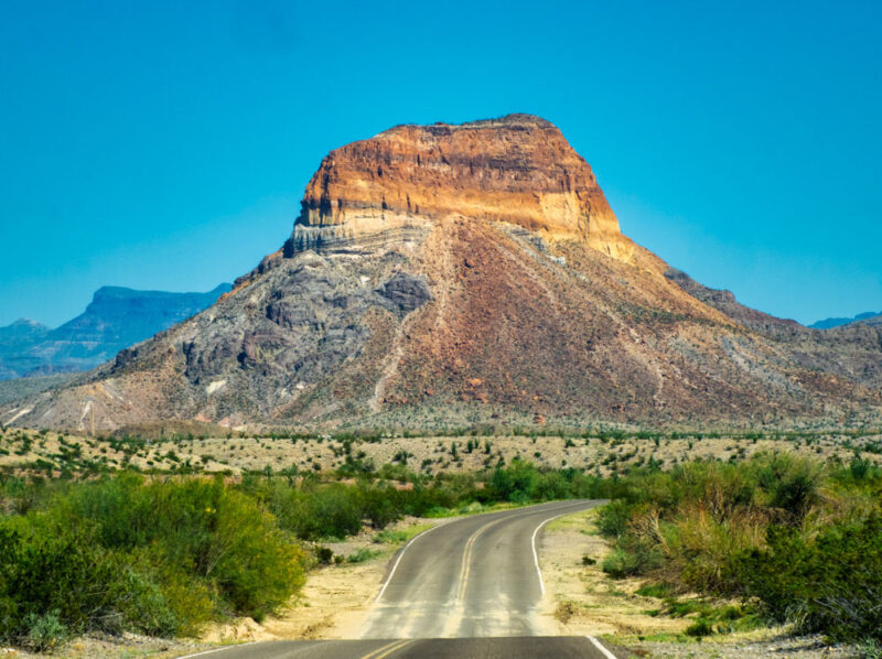
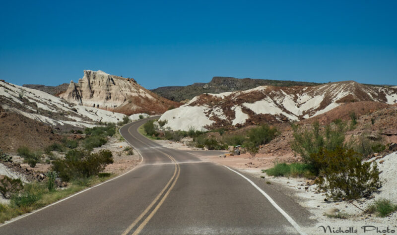
There are many things to see on Ross Maxwell Scenic Drive, all marked on the official map which you should not fail to pick up when you enter the park. People interested in geology will have a lot of fun on this road!
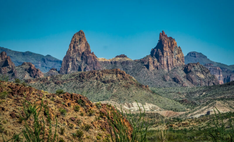
Mule Ears is one of the interesting formations…
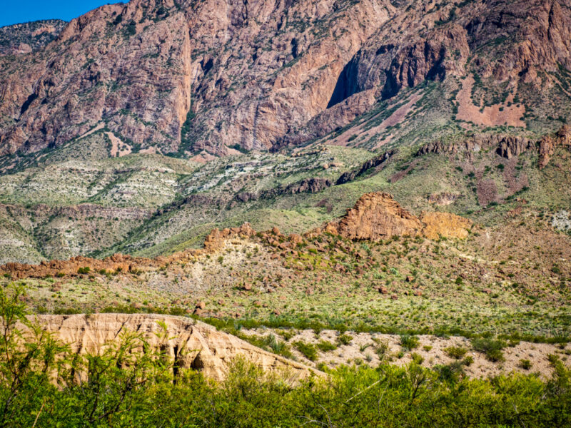
Two rows of volcanic dikes are marching across the landscape in the photograph above. The things that look like rock walls are the dikes, one yellowish and the other, behind it, darker. These are igneous dikes, where magna pushed up through cracks and then cooled and crystallized.
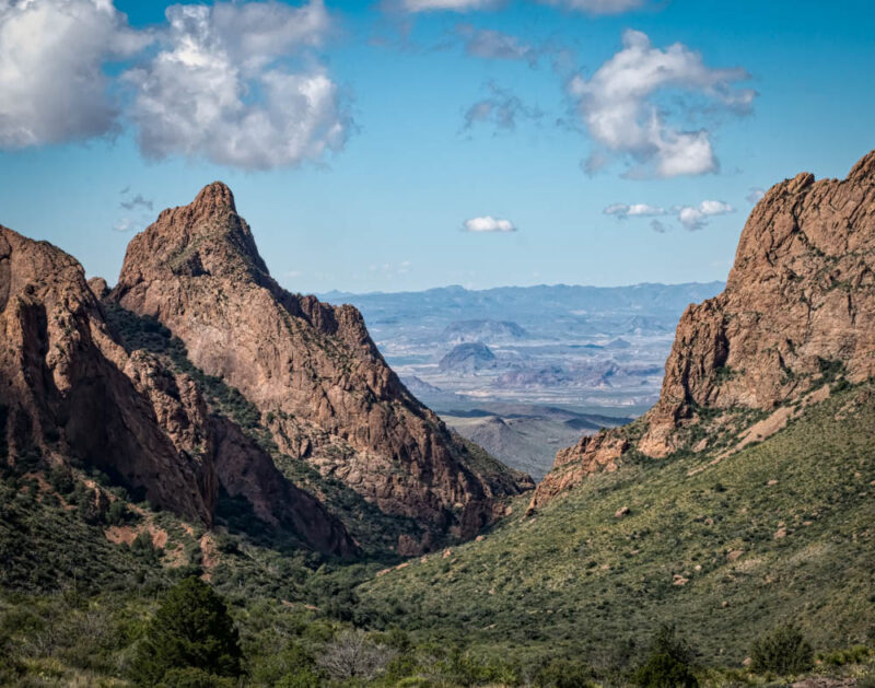
If you go into Chisos Basin, in the Chisos Mountains, you will want to take the Window Trail and view the terrain down below. The photograph below is what the “window” looks like from the west, looking up toward the Chisos Mountains and the Basin.
Below is a photograph from the window trail in Chisos Basin looking toward where the photo above was taken from. This photo was taken in 2018.
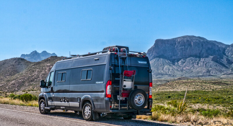
We returned to Study Butte for the night and the next day entered the park again to drive through the park again and down to Rio Grande Village. This is the beast we traveled in…
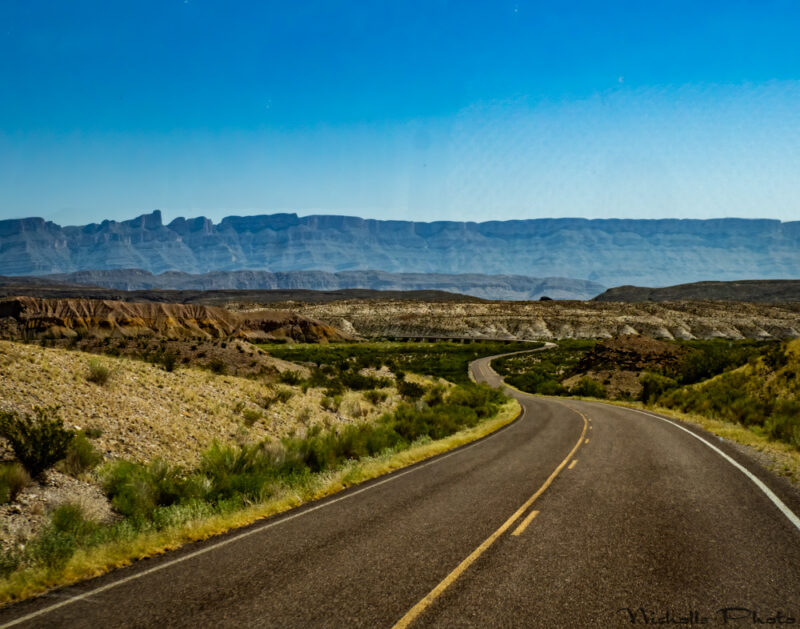
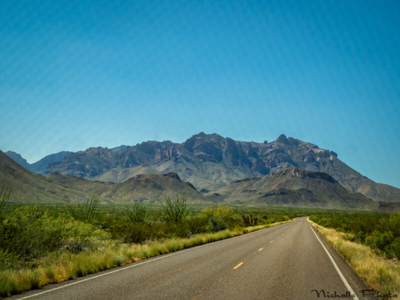
The photo below was taken through the front windshield into the haze from the road going down to Rio Grande Village… The blue mountains in the background are in Mexico. The Rio Grande River is on this side of them.
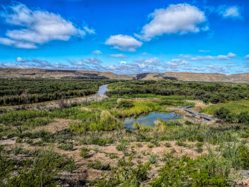
This area was a disappointment… Since the campground was closed, we could not go to one of our favorite places to look at the Rio Grande River because that trail starts in the campground and all roads into that area were blocked. Below is a picture of the Rio Grande and the wetlands from the Rio Grande Village Nature Trail in 2018. Mexico is in the upper left on the other side of the river.
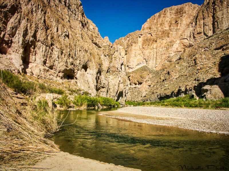
Another hike we didn’t do on this trip is to the entrance to Boquillas Canyon. Here’s a photo from 2006.
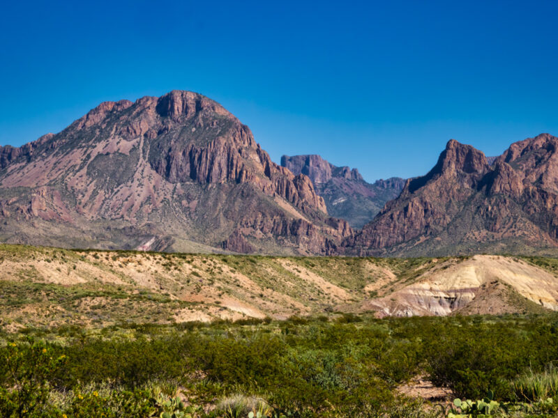
The drive out of the park to the north is not as interesting as most of the drives in the park. This view is before you get to Panther Junction… of the Chisos Mountains from the east side. And, oh, look, some more dikes!
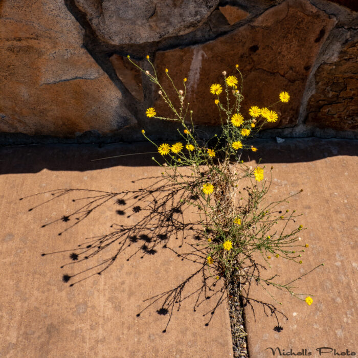
I like to photograph plants who have made the best of what they have available…
We drove out toward Marathon where we spent the night in an RV park. Alas, cooking our own food as we had this entire pandemic trip… If it had been normal times, we would have had dinner at the Gage Hotel.
We made a leisurely trip home to Wimberley by overnighting at the always enjoyable South Llano River State Park.
No Comments